Trusted Worldwide | 250+ Cities Designed | 5 Million + Premises Connected

27th Oct 2025 0
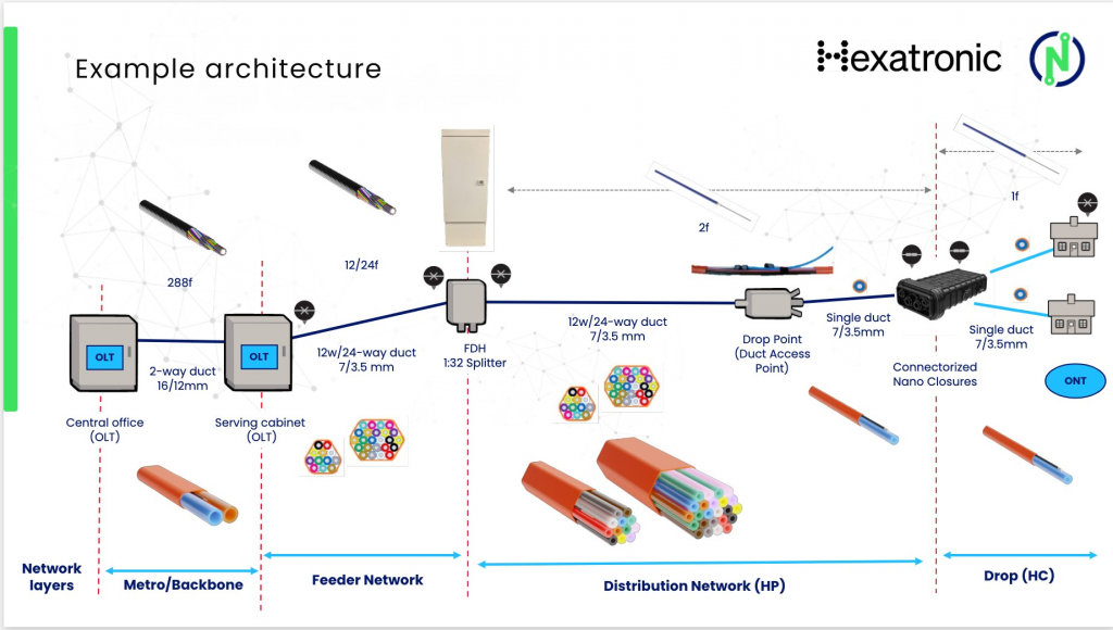
Focus Air Blown Fiber
NetPMD Overview
- NetPMD Focus on Design/Engineering as well as Active Integration services
- Hexatronic Approved
- Over 6 years experience with Air Blown Fiber solutions
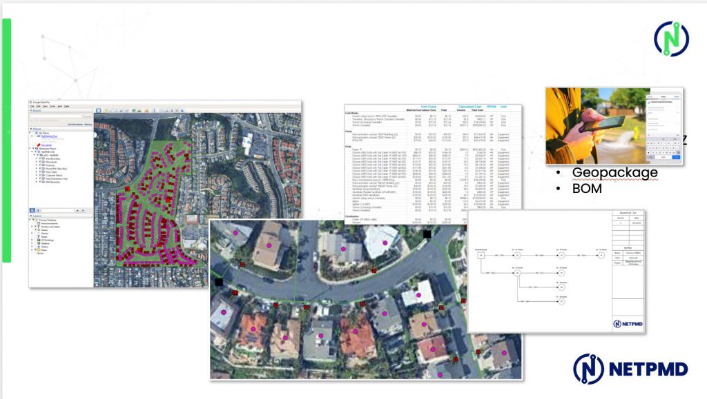
Design/Engineering Services
- – Address validation
- – Design shape files in Hexatronic schema
- – BOM creation
- – LLD, PD, CD, ABF, BOM – Built upon the HLD and incorporated:
- – Mobile GIS Survey data
- – Additional properties
- – Moving all equipment and bore-lines to the planned construction path
- – Adding design detail and architecture
- – Producing ABF forms, duct allocation, permit drawings, construction drawings,and final BOMs
- – As-built data capture and documentation
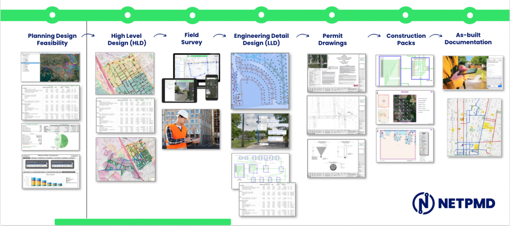
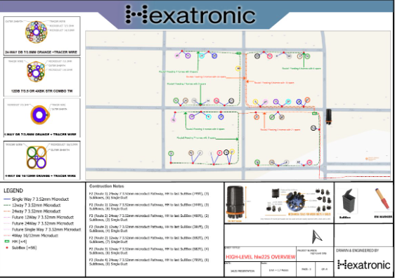
Design Overview
Design/Engineering Output
Focus Air Blown Fiber
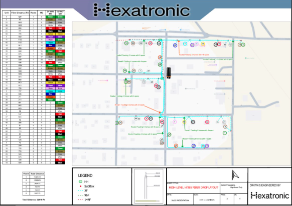
Deliverables
- Route layout maps (GIS, PDF, or AutoCAD)
- Duct configuration drawings (multiway, single routes)
- Chamber and node schematics
- Blow distance and bend radius validation table
- OTDR testing and O&M guidelines (optional)
- As-built update files
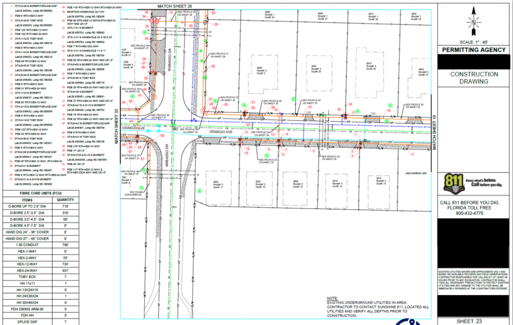
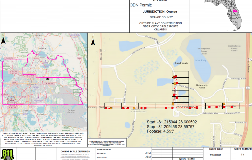
Permit Drawings
NetPMD adopts a proactive approach to any jurisdiction to make sure we understand all local market requirements
Helpful information that we ask of jurisdictions and customers.
- – Parcels Data (preferably from the County level to encompass any neighboring cities)
- – Address points
- – City and neighboring city boundaries
- – Centerlines
- – Wet Utilities Data (Water, Storm, and Sewer)
- – Known Private Properties
- – Road Classifications
- – Road Moratoriums
- – Street Restoration for i.e.: stone, concrete, trolly or commuter train roadways
- – Trench Depths
- – TCP requirements and notes
- – Street Limit maps
- – General City Notes for permit
- – Hours for construction
- – Road ownership/permit owner (are there any roads that are shared with DOT)
- – PUE Data
- – Permitting requirements (license, bonds, insurance)
- – Permit Size
- – Permit Cost
- – Permit Duration
- – Permit Expiration
(we prefer shp files for any data that can be obtained)
- – Construction method (bore, trench, micro trench)
- – Preferred location (roadway, gutter, soft scape, back of sidewalk)
- – Chamber/HH sizes per project (detail sheets if you have them)
- – What if any standard operating procedures that have been shared with the jurisdictions that can be shared with us
Other Services
Active Integration
- Cabinet installation
- Optical, routing and switching
- Data centers and huts - design/installation
- Management/monitoring/provisioning systems
- OSP integration
- ISP integration - inside plant
- ISP integration - internet service providers
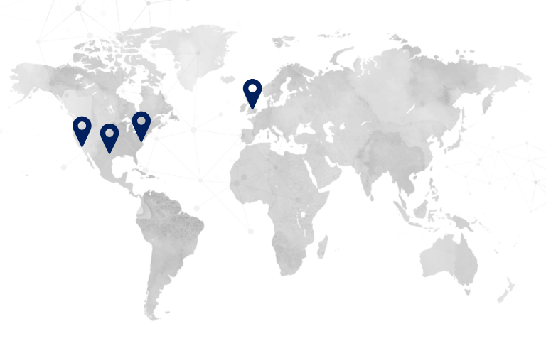
Contact us
Francine – US Business Development
☎️ 908-310-2913
Patrik – VP Client Solutions
☎️ 201-279-1281
Recent Posts
 The 58,000-Role Problem Facing US Fiber Deployment
March 4, 2026
 Another Year of Growth, Delivery & Partnerships
December 18, 2025
